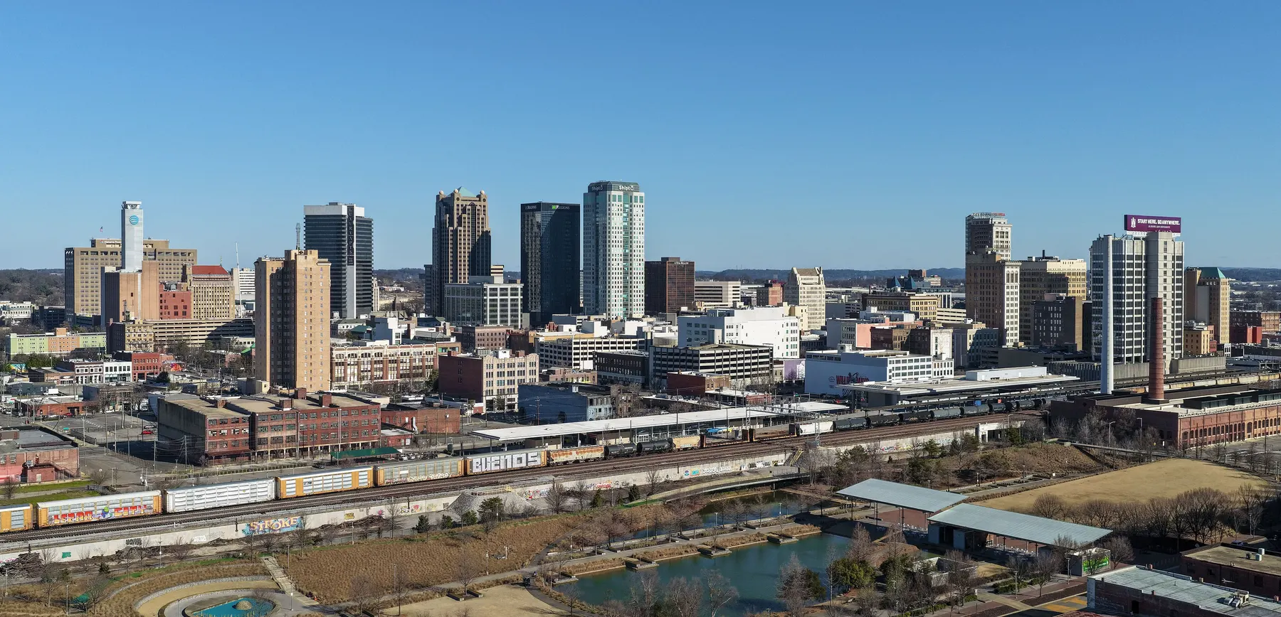
Twelve of Birmingham's 99 neighborhoods, from Downtown to Ensley, with ZIP codes, zoned high schools and Zillow home values for September 2026.
Last checked Oct. 17, 2026. Sources: the City of Birmingham’s 23 communities and 99 neighborhoods list and neighborhood boundary files, its comprehensive plan (PDF) and parks list; Birmingham City Schools’ Find My Zone; the Alabama State Department of Education’s state report card for 2025; Zillow Research; the Census Bureau; and OpenStreetMap.
Birmingham is a city of 198,173 people, according to the Census Bureau’s 2020-2024 American Community Survey five-year estimates, and almost all of it is in Jefferson County. Red Mountain runs along the south side of the city, and the railroad corridor runs through the middle of downtown. I-20/59 crosses the city from Ensley in the west to Woodlawn and the airport in the east, I-65 runs north to south just west of downtown, I-22 heads northwest and the Red Mountain Expressway (U.S. 31 and U.S. 280) climbs over the mountain to the south.
The city itself defines its neighborhoods. It lists 99 neighborhoods in 23 communities, each with elected neighborhood officers under its Citizen Participation Program, and publishes their boundaries as open data. This guide uses those boundaries.
Three things to know before you look at a listing:
- ZIP codes do not follow the city line. Fifteen ZIP codes each have at least a tenth of their land inside Birmingham, by the Census Bureau’s count, and several cross into neighbors. Part of Crestwood South uses 35213, which Zillow files under Mountain Brook; part of Glen Iris uses 35209, filed under Homewood; and much of Roebuck uses 35215, filed under Center Point. A Birmingham mailing address is not proof of a Birmingham tax bill, so check the parcel. See our property taxes guide.
- Schools follow the city line, not the neighborhood line. Every home inside the city is served by Birmingham City Schools, but the zones cut across neighborhoods: the West End and Southside areas in this guide are each split between two high school zones. Check one address with the district’s Find My Zone.
- Home values vary more than fivefold by ZIP code. In September 2026 the Zillow Home Value Index ran from $70,260 in 35204 to $393,070 in 35222 among the ZIP codes Zillow files under Birmingham in this guide. The citywide figure was $134,165, down 2.4% in a year.
The areas at a glance
Home values are the Zillow Home Value Index for the area’s main ZIP code in September 2026, a modeled typical value for the middle third of homes, not a sale price. Several areas share a ZIP code, so they share a figure.
| Area | Main ZIP code | Zoned high school | Typical home value in the ZIP |
|---|---|---|---|
| Downtown (Central City) | 35203 | Parker High | $315,376 |
| Southside | 35205 | Split: Parker High or Woodlawn High | $227,114 |
| Highland Park | 35205 | Woodlawn High | $227,114 |
| Forest Park and South Avondale | 35222 | Woodlawn High | $393,070 |
| Crestwood | 35212, 35222 | Woodlawn High | $115,880 (35212) |
| Woodlawn | 35212 | Woodlawn High | $115,880 |
| East Lake | 35206 | Woodlawn High | $99,980 |
| Roebuck | 35215, 35206 | Huffman High | $152,778 (35215) |
| Norwood | 35234 | Carver High | $91,235 |
| West End | 35211 | Split: Parker High or Wenonah High | $73,479 |
| Bush Hills | 35208, 35204 | Jackson-Olin High | $75,427 (35208) |
| Ensley | 35218 | Jackson-Olin High | $71,332 |
On the 2025 state report card (the 2024-25 school year), Carver High scored 72 (a C), Wenonah High 73 (C), Huffman High 71 (C), Parker High 66 (D), Woodlawn High 61 (D) and Jackson-Olin High 60 (D). The district as a whole scored 77 (C). The district also runs schools that students apply to; see its specialty schools page and our schools guide.
The map
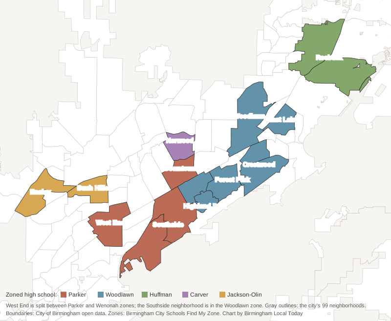
Neighborhood boundaries are from the City of Birmingham’s open data; zones are from sample points in Birmingham City Schools’ Find My Zone tool.
The areas
Downtown (Central City). The city’s Central City neighborhood between I-20/59 and the railroad, with Linn Park, the Central Library and Sloss Furnaces, served by eight MAX routes. Zoned for Phillips Academy, Wilkerson Middle and Parker High.
Southside. The community of Five Points South, Glen Iris and Southside, with UAB, Railroad Park, Five Points, Vulcan Park and the 83-acre George Ward Park. Most of it is zoned for Parker High; the Southside neighborhood is zoned for Woodlawn High.
Highland Park. A 323-acre neighborhood on the lower slope of Red Mountain with its own form-based zoning overlay and four small city parks, including Rhodes Park. Zoned for Avondale Elementary, Putnam Middle and Woodlawn High.
Forest Park and South Avondale. Avondale Park (36.5 acres), the Avondale Regional Branch Library and the shops on Clairmont Avenue South. Same schools as Highland Park.
Crestwood. Crestwood North and Crestwood South on the Mountain Brook line, with the 12-acre Crestwood Park and a city pool. Same schools as Highland Park.
Woodlawn. A historic commercial district on 1st Avenue North, Woodlawn High and, on the city’s map, the airport. Zoned for Hayes K-8 and Woodlawn High.
East Lake. 1st Avenue North east of Woodlawn, with Downey Park, a supermarket and a pharmacy inside the line and East Lake Park just north. Zoned for Barrett Elementary, Ossie Ware Mitchell Middle and Woodlawn High.
Roebuck. Roebuck and Roebuck Springs in the northeast, built mostly from the 1960s on, with the 113-acre Roebuck Park and a city golf course. Zoned for Huffman High.
Norwood. North of downtown along the Norwood Boulevard park trail, with Norwood Elementary inside. Zoned for Carver High.
West End. Arlington-West End on Tuscaloosa Avenue, with the Arlington house and a branch library. Split between the Parker High and Wenonah High zones.
Bush Hills. A 1920s neighborhood added to the National Register of Historic Places in 2024, with Bush Hills STEAM Academy inside. Zoned for Jackson-Olin High.
Ensley. A town until the 1910 annexation, with Ensley Park, two branch libraries and Jackson-Olin High. Zoned for Wylam Elementary and Jackson-Olin High.
Comparing Birmingham with its neighbors? See Birmingham vs Mountain Brook vs Homewood vs Tarrant. More in our moving to Birmingham, schools, home prices, parks and trails and getting around guides.
How we built this
We listed only areas that the city names and that we could place on a map:
- The City of Birmingham’s list of 23 communities and 99 neighborhoods and its neighborhood boundary file on the city’s open data portal. Each page is one city neighborhood or, for the Southside, Crestwood and Roebuck, two or three neighborhoods of one community.
- The city’s comprehensive plan for each area’s history and the city’s plans for it, and its parks, pools and recreation center lists for park names and acreage.
- Birmingham City Schools’ Find My Zone tool, queried at sample points spread across each area, for zoned schools; the state report card for scores.
- Census ZIP code areas for ZIP codes, MAX Transit’s schedule data for bus routes, and OpenStreetMap for stores, libraries, interstate exits and road distances, © OpenStreetMap contributors.
We picked 12 areas to spread across the city; the other 87 neighborhoods are on the city’s list. Areas are described from public records only. We do not rank them.
Frequently asked questions
How many neighborhoods does Birmingham have?
99, grouped into 23 communities, according to the city. Each neighborhood elects its own officers under the city’s Citizen Participation Program.
What are the neighborhoods in Birmingham, Alabama?
Our guide covers 12: Downtown (Central City), the Southside (Five Points South, Glen Iris and Southside), Highland Park, Forest Park-South Avondale, Crestwood, Woodlawn, East Lake, Roebuck, Norwood, West End, Bush Hills and Ensley. The city’s full list of 99 is on its website.
Do Birmingham ZIP codes match the city limits?
No. Several ZIP codes cross into neighboring cities: part of Crestwood South uses 35213, which Zillow files under Mountain Brook, part of Glen Iris uses Homewood’s 35209, and much of Roebuck uses 35215, which Zillow files under Center Point.
Which high school will my Birmingham address be zoned for?
Birmingham City Schools assigns schools by address, and zones do not follow neighborhood lines: West End and the Southside are each split between two high school zones. Check one address in the district’s Find My Zone tool.
What is the typical home value in Birmingham?
$134,165 in September 2026, down 2.4% in a year, according to the Zillow Home Value Index. By ZIP code in our guide it ranged from $70,260 in 35204 to $393,070 in 35222, leaving out ZIP codes Zillow files under other cities.
Have your say