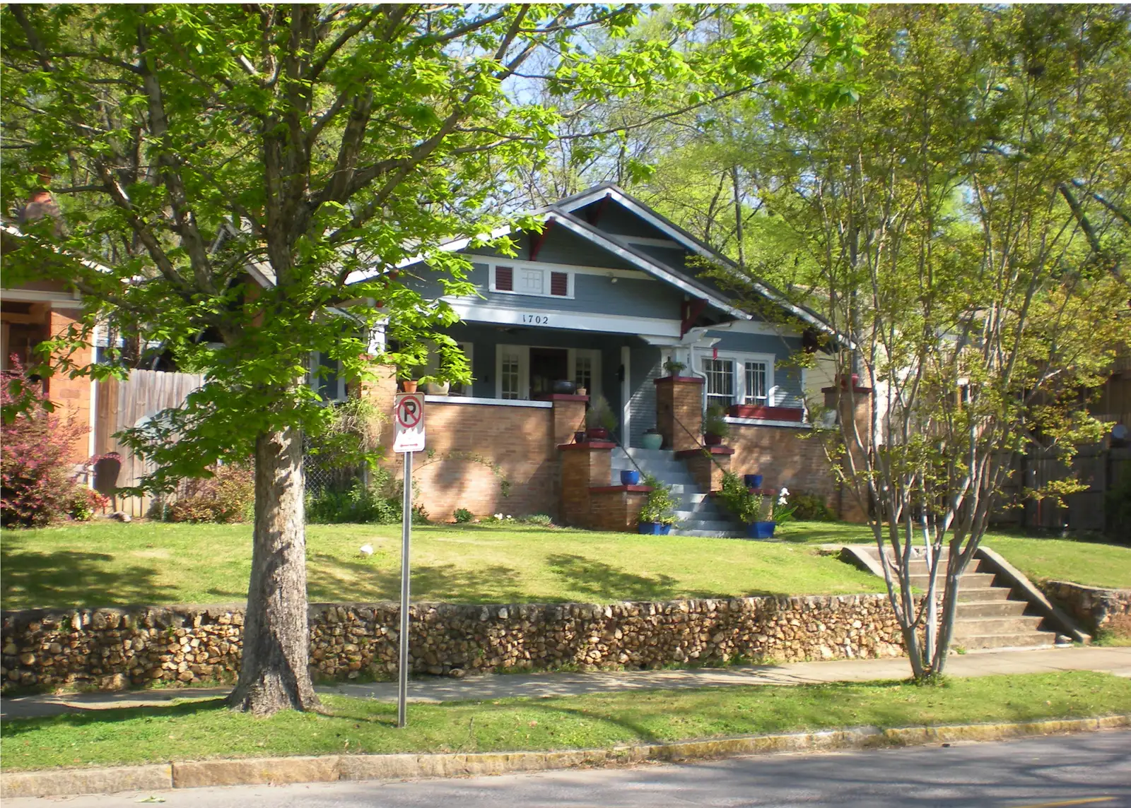
The Southside community: Five Points South, Glen Iris and Southside. Most of it is zoned for Parker High; ZIP 35205 was $227,114 in September 2026.
Last checked Oct. 17, 2026. Sources: the City of Birmingham’s 23 communities and 99 neighborhoods list and neighborhood boundary files, its comprehensive plan (PDF) and parks list; Birmingham City Schools’ Find My Zone; the Alabama State Department of Education’s state report card for 2025; Zillow Research; MAX Transit’s schedule data; and OpenStreetMap.
The Southside is one of the city’s 23 communities, and it has three neighborhoods on the city’s map: Five Points South, Glen Iris and Southside. Together they cover about 3,270 acres south of the railroad, from downtown up the slope of Red Mountain. Five Points South is the largest and takes in the University of Alabama at Birmingham campus, Railroad Park, the Five Points entertainment district and Vulcan Park on the ridge. The city’s comprehensive plan counts Five Points South as part of greater downtown and notes its “healthy urban tree canopy.”
What this means for you
- Zoned high school: Parker High for Five Points South and Glen Iris (2025 state report card: 66, a D); Woodlawn High for the Southside neighborhood (61, a D).
- Home value: $227,114 in ZIP 35205 in September 2026, according to the Zillow Home Value Index.
- Nearest interstate exit: I-65 exit 259 (University Boulevard), on the west side.
Part of our Birmingham neighborhoods guide.
Where it is
The community runs from the railroad corridor south of downtown to the crest of Red Mountain, between I-65 on the west and the Highland Park and Forest Park neighborhoods on the east. The Red Mountain Expressway (U.S. 31 and U.S. 280) cuts through it.
- Five Points South covers UAB, Railroad Park, the Five Points district around Magnolia Avenue South and 20th Street South, and Vulcan Park.
- Glen Iris is the western part, around George Ward Park, Bessie Estell Park and Green Springs Avenue.
- Southside is the smaller eastern neighborhood, south of the railroad and north of Highland Park, with Underwood Park and the east end of the Rotary Trail.
Most homes are in ZIP code 35205. The UAB side is in 35233, and the southern edge of Glen Iris near Green Springs Highway is in 35209, a ZIP code Zillow files under Homewood. The city converted Richard Arrington Jr. Boulevard South through Five Points South to two-way traffic from Highland Avenue South to University Boulevard in March 2026, according to its announcement.
Schools
We checked 150 points across the community in the district’s Find My Zone tool. Five Points South and Glen Iris (124 points) returned one set of schools and the Southside neighborhood (26 points) another. Scores are each school’s overall score on the 2025 state report card (the 2024-25 school year).
| Neighborhood | Level | School | Address | 2025 score (grade) |
|---|---|---|---|---|
| Five Points South, Glen Iris | Elementary | Glen Iris Elementary | 1115 11th St. S. | 78 (C) |
| Five Points South, Glen Iris | Middle | Washington K-8 | 115 4th Ave. S. | 81 (B) |
| Five Points South, Glen Iris | High | Parker High | 400 Rev. Abraham Woods Jr. Blvd. | 66 (D) |
| Southside | Elementary | Avondale Elementary | 4000 8th Court S. | 83 (B) |
| Southside | Middle | Putnam Middle | 1757 Montclair Road | 67 (D) |
| Southside | High | Woodlawn High | 5620 1st Ave. N. | 61 (D) |
Find My Zone lists Washington as the zoned school for sixth to eighth grade here. Check one address in Find My Zone or on the district’s zoning page. More in our schools guide.
Home values
From the Zillow Home Value Index, a modeled typical value for the middle third of homes, not a sale price:
| ZIP code | September 2026 | September 2025 | Change |
|---|---|---|---|
| 35205 | $227,114 | $231,366 | -1.8% |
| 35233 | $302,968 | $313,128 | -3.2% |
| 35209 (filed under Homewood) | $536,460 | $502,785 | +6.7% |
| Birmingham, citywide | $134,165 | $137,465 | -2.4% |
35209 is mostly Homewood, so its figure says little about the Glen Iris homes inside it. More in our home prices and property taxes guides.
Parks and trails
From the city’s parks list, with the acreage it gives:
- George Ward Park, 83.73 acres, 1901 Green Springs Ave. S., in Glen Iris, with a disc golf course mapped in OpenStreetMap.
- Bessie Estell Park, 5.2 acres, 901 8th St. S., also in Glen Iris.
- Brother Bryan Park, 2.2 acres, 2100 Magnolia Ave. S., at Five Points.
- Valley View Park (1.18 acres) and Phelan Park (0.38 acre) in Five Points South, and Underwood Park in the Southside neighborhood.
- Rotary Trail and the Kiwanis Vulcan Trail, both on the city’s list.
Railroad Park, on the downtown edge, and Vulcan Park, on the ridge at 1701 Valley View Drive, are inside Five Points South on the city’s boundary map. More in our parks and trails and walking and biking trails guides.
Getting around
- Interstates: I-65 exit 259 (University Boulevard), 259A (6th Avenue South) and 259B (4th Avenue South) on the west side, and exit 258 (Green Springs Avenue) for Glen Iris. Exit names are from OpenStreetMap’s ramp signs.
- City Hall: about 2.3 miles by road from the middle of the community.
- Airport: about 7.1 miles by road to Birmingham-Shuttlesworth International Airport. Distances are measured on the OpenStreetMap road network with the OSRM routing engine; they are distances, not drive times.
- Buses: six MAX Transit routes stop inside the community in the schedule data valid through Oct. 28: 14 Idlewild Palisades (the most stops), 31 Highway 31 South, 280 Highway 280, 25 Centerpoint, the Magic City Connector (Route 90) and the Birmingham Xpress (BX).
More in our getting around guide.
Groceries and everyday stores
From OpenStreetMap, inside the community or within about half a mile:
- Publix, 230 20th St. S., and Publix, 411 Green Springs Highway.
- Walmart Neighborhood Market, 312 Palisades Blvd.
- ALDI, 428 Green Springs Highway, and Mi Pueblo Supermarket, 216 Green Springs Highway.
- CVS Pharmacy, 1431 11th Ave. S., and Walgreens, 3020 Clairmont Ave. S.
The Southside Branch Library is at 1814 11th Ave. S.
How we drew this area
The area is the three neighborhood polygons of the Southside community in the city’s open data boundary file, checked Oct. 17, 2026. School zones are from 150 sample points in the district’s Find My Zone tool; ZIP codes are from Census ZIP code areas. Place and store locations are © OpenStreetMap contributors.
Frequently asked questions
What neighborhoods are in Birmingham’s Southside?
The city’s Southside community has three neighborhoods: Five Points South, Glen Iris and Southside. Five Points South takes in the UAB campus, Railroad Park and Vulcan Park on the city’s boundary map.
What high school is Five Points South zoned for?
Parker High. Five Points South and Glen Iris are zoned for Glen Iris Elementary, Washington K-8 for the middle grades and Parker High; the smaller Southside neighborhood is zoned for Avondale Elementary, Putnam Middle and Woodlawn High, according to the district’s Find My Zone tool.
What is the typical home value in ZIP 35205?
$227,114 in September 2026, down 1.8% in a year, according to the Zillow Home Value Index. ZIP 35233, which covers the UAB side, was $302,968.
Is Five Points South a good place to live?
Here are the facts. Five Points South holds the UAB campus, Railroad Park and Vulcan Park, is zoned for Parker High (66 on the 2025 state report card) and is served by six MAX bus routes; the typical home value in ZIP 35205 was $227,114 in September 2026, according to Zillow.
Have your say